
Learning to read nautical charts is essential in the shallow waters of the keys. Charts can look intimidating to the uninitiated, but we hope to demystify them for you.
WHERE TO PURCHASE A CHART:
You can find charts of local waters at nearby bait & tackle shops or marine supply retailers.
SCALE:
When you are buying a chart of specific waters, you typically have a choice between a chart that covers a smaller area in greater detail or one that covers a larger area in less detail. Assuming you are a novice, we recommend a detailed chart of the local area. Small-craft charts come folded like a road map for more convenient use on smaller boats. Small craft charts typically ise a scale that is about 1 nautical mile per inch, and cover an area of about 30 or forty miles.
DEPTH:
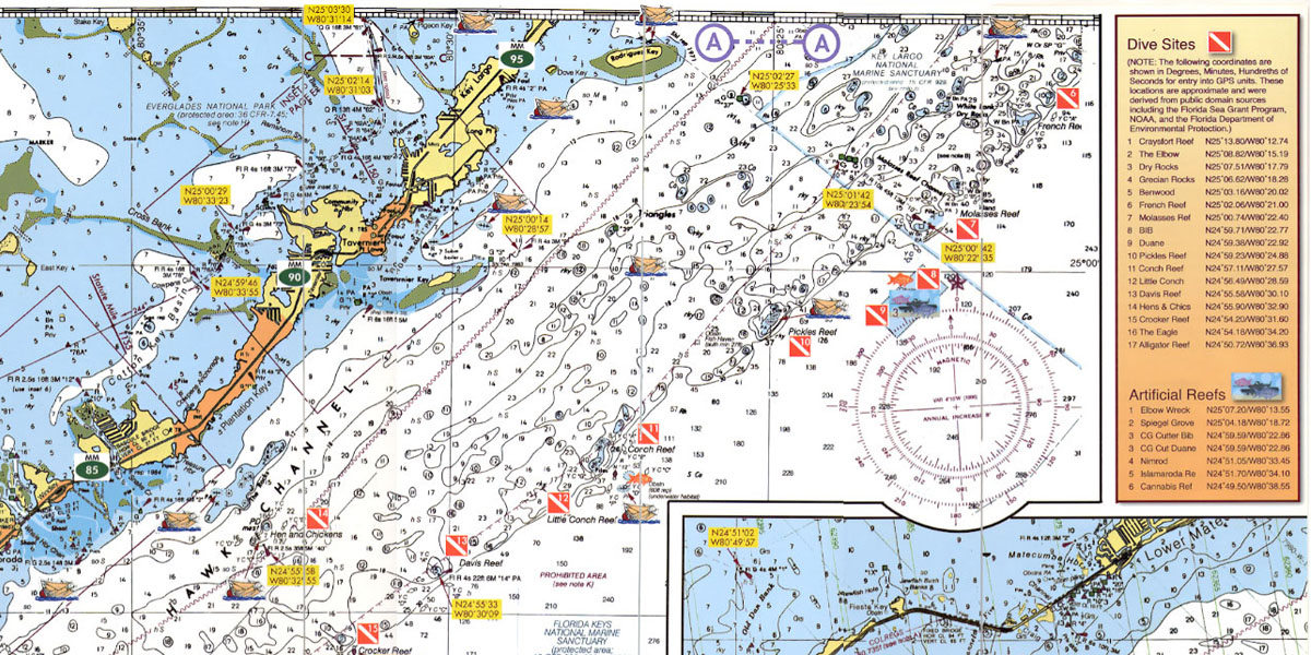
Numbers printed on the water areas of the chart indicate the depth of the water at that spot. However, a 2 on the chart might mean two feet, two fathoms, or two meters. It is essential to know which unit of measurement is used. This is always shown on the face of the chart in large print — SOUNDINGS IN FATHOMS AND FEET, for example. A fathom, by the way, is six feet, so on a chart with soundings in fathoms, a number such as 03 means zero fathoms and three feet. To simplify matters, try to find a chart that lists depth in feet. The depths listed are for low tide, so the actual depth is usually a little bit more than the charted depth.
As a novice boater, we recommend you avoid areas marked as 3 feet or less.
BLUE & WHITE AREAS ON A CHART
On most modern charts, a light blue color indicates shallower water, white indicates deeper water.
CHART SYMBOLS
In addition to water depths, charts show the location of rocks, reefs, wrecks and other submerged obstructions, anchorages, channels, lighthouses, buoys, and even tide rips. The symbols and abbreviations for these features are often obvious but sometimes not always. Your chart may contain a Key (an explanation of more common symbols), but we highly recommend you visit the NOAA site at: https://nauticalcharts.noaa.gov/publications/docs/us-chart-1/ChartNo1.pdf , download and study this comprehensive list of nautcal chart symbols.
NAVIGATION AIDES:
Red daybeacons are shown on your chart as small triangles. The green ones — any color but red, actually — appear as small squares. Lighted markers have a magenta flare symbol — like an exclamation mark. A variety of symbols are used for buoys. Lighthouses are generally shown as a dot inside a magenta disk, sometimes with the flare symbol. All of these symbols are explained in the NOAA site PDF. (See previous paragraph).
Prominent land features, such as towers, buildings, and even hills may also be shown on the chart if they might be valuable to the navigator. Many older charts also include Loran-C time distance lines.
THE COMPASS ROSE
At various locations on the chart you will find groups of three concentric circles of ruler-like hatch marks. This is called a compass rose, and it indicates true north — the outer circle — and magnetic north — the inner circles. Since you are almost certain to be steering by magnetic compass, you will nearly always use the inner circles, normally the one marked in degrees from 0 to 360.
For a more complete understanding of charts and navigation, we recommend Boat Navigation for the Rest of Us by Captain Bill Brogdon. You can purchase this book on Amazon.